
Our inventory module provides a clear, detailed overview of your forest, supporting proactive management. By regularly tracking vital parameters, you gain a up-to-date snapshot of your forest’s current condition and future potential—ensuring that your felling planning and risk management efforts are based on reliable data.
"We have never had a basis for decision of this quality. This inventory would have never happened without the technology from Arboair"
— Henrik Pålsson, Purchase Manager, Holmen
Experience the efficiency of automated digital forest inventory and take your forest management to the next level.
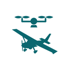
To deliver our analysis a new data collection is conducted to ensure analysis quality and up to date information. The data can be collected by you, your subcontractor or you can hire one of Arboair's certified partners for data collection. Data is collected by drones, airplanes or satellites.
In some cases existing data can be used if the data is of the right quality.
Our unique analysis capacities optimize the usage of your drone by letting you capture only a few images per hectare instead of traditional methods where extensive data collection is needed. With only one image we can extract all necessary information about the trees.

We process the images and generate up to date ortho photos of the forest and height models. Our technology agnostic approach helps you use the data efficiently by using the right tool for the right job.

The photos and height maps are analyzed by our models to generate information about every tree. Giving the foundational database information about tree height, crown size, breast height diameter, and species group we create operational maps and statistical data for you to take action on.
Giving you a data-driven approach in decision-making processes for:
The data is stored in a database that can be connected to your GIS software and management platform.
The data can then be used both in planning operations and field work.
With seamless integrations the data can be sent to a harvester for more data-driven operational actions in the harvesting.